
 Posted by
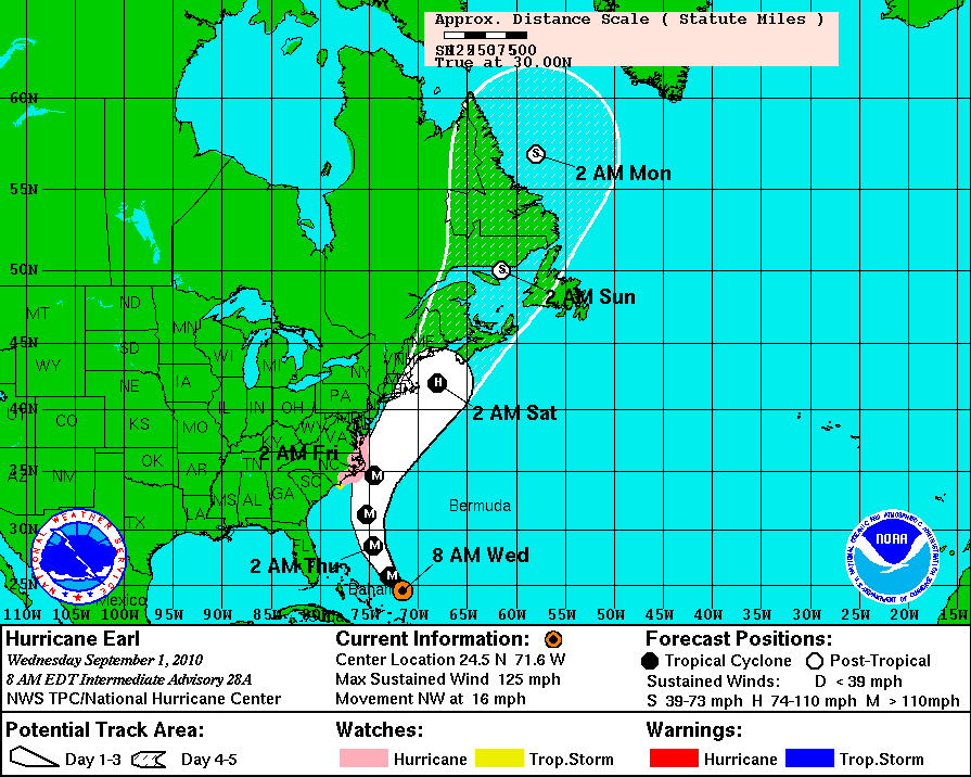
The 8AM NHC Projected Path for Hurricane Earl
Hurricane Earl remains a major hurricane this morning, as it moves northwest at about 16 miles per hour. The national Hurricane Center has revised their projected path slightly to the west since yesterday, indicating that the Outer Banks of NC may experience strong hurricane force winds. The path takes it just offshore of the Outer Banks sometime early Friday morning, as still a major hurricane. It’s forward speed should pick up there after, placing Earl somewhere east of Cape Cod by early Saturday morning. Please see the 8am NHC projected path inset above. All interests along the US East Coast need to pay close attention to any changes made to the projected path over the next 24-48 hours.
