
 Posted by
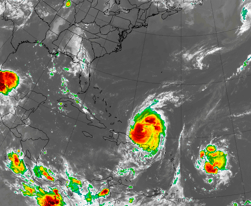
An Enhanced Satellite View of Fiona and Earl
Hurricane Earl is still a category 4 hurricane with winds up to 135 miles per hour. It is slowly moving to the WNW at 13 miles per hour, and is expected to remain a major hurricane for days to come. Right now the expected path of Earl is one which will bring it about 150 miles east of the Northern Bahamas by Thursday Morning. Next Earl turns a bit more northward, placing it somewhere off the coast of the Out Banks of NC by Friday morning. It’s still too early to tell just how close it gets, and whether it makes landfall in North Carolina on Friday. It will then skirt along the coast of the Mid-Atlantic and New England, and by Saturday morning be somewhere off of Cape Cod. The cone of error is very large by this time, so whether Cape Cod gets a full blown hurricane, or just squalls is yet to be seen. It will then race into Nova Scotia, as likely a category 1 or 2 hurricane.
Tropical Storm Fiona is located about 800 miles west of Earl. For now the main concern should be directed towards Major Hurricane Earl, however this tropical storm will likely be several hundred miles from the US East Coast come Saturday morning, possibly stalled. From there, it is anyone’s guess where it goes. Out to seas, into Florida, into the Carolina’s, or up the East Coast are all possibility.
