
 Posted by
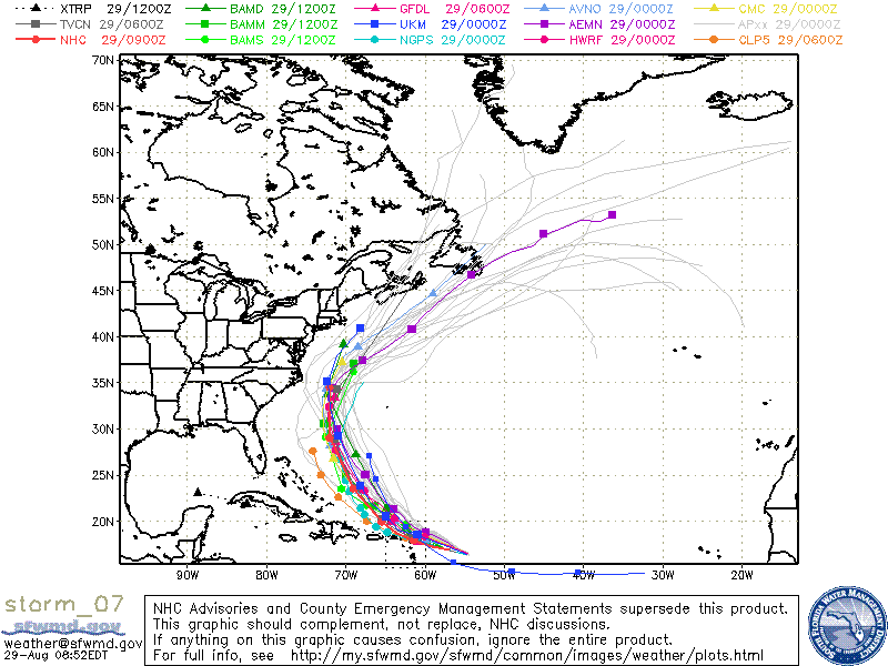
Several Computer Model Tracks for Hurricane Earl
Top winds are at 75 miles per hour, and it is moving west at 18 miles per hour. A Hurricane warning is posted for the Northern Leeward Islands and a hurricane watch is posted for Puerto Rico, as Hurricane Earl is projected to track just north of that area. Many people living on the East Coast of the US, including Florida, the Carolina’s and New England have been worried that Hurricane Earl may track their way. Right now the NHC predicts a path that will Take Earl approximately 150 miles off the coast of the Outer Banks of North Carolina. What residents of the East Coast need to realize though is that the cone of error, 5 days out, can be extremely large. Even according to the NHC, the shores of North Carolina, Virgina, and Maryland remain in this cone.
All Residents along the East coast should keep one eye on the storm this week, as any shifts in it’s forecast path could result in quite a surprise. Although right now, best guests have the storm veering out to sea before reaching shore in the US, hurricane tracks can be very difficult to forecast accurately.
